 |
||||
|
|
||||
|
|
|
|
|
|
|
|
|
|
|
|
|
|
|
|
|
French Huguenots |
|
|
|
|
|
|
|
|
|
|
|
|
|
|
|
|
|
|
|
|
|
|
|
|
|||
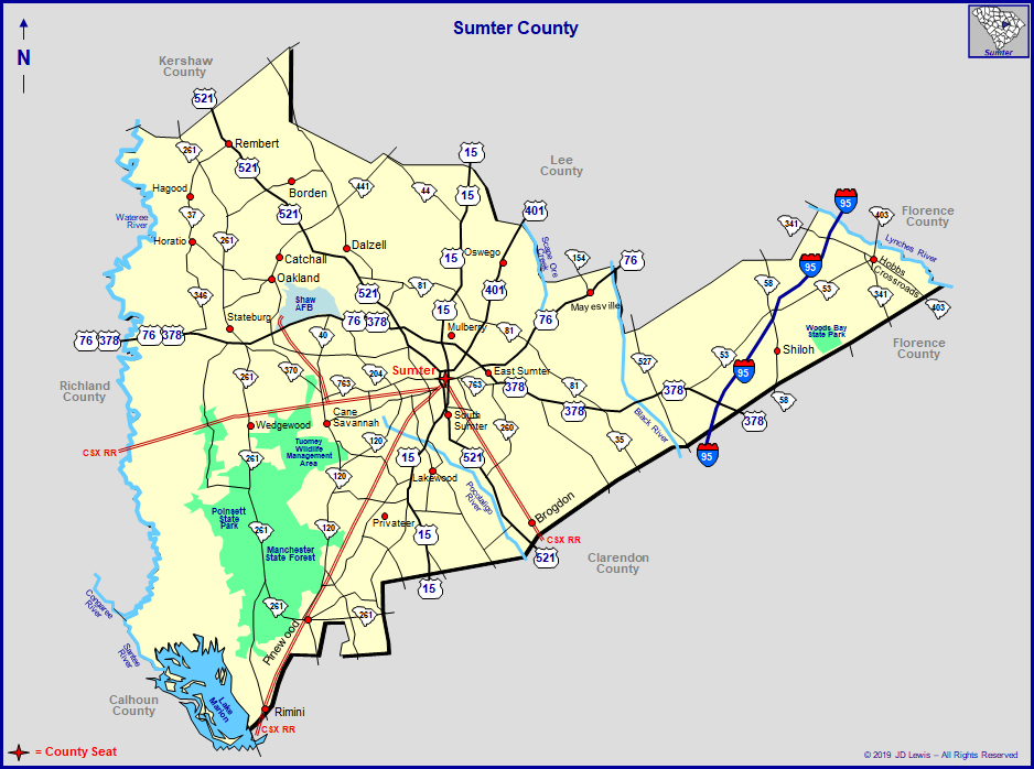
 Thomas Sumter Sumter County and its county seat, the city of Sumter, were named for Revolutionary War Brigadier General Thomas Sumter (1734-1832), who was a resident of the area. This county has changed its boundaries several times. In 1785, Claremont County was formed as a part of Camden District, which was earlier part of the original Craven County. A part of the county was later split off in 1791 to form Salem County. Claremont, Clarendon, and Salem counties were combined into the Sumter District (county) in 1798 to be effective on January 1, 1800. Clarendon was once again split off in 1855, however, and another small part of Sumter County went to form Lee County in 1902. This part of the state began attracting English settlers from the lowcountry and from Virginia in the mid-eighteenth century. The area known as the High Hills of Santee, a narrow ridge along the Wateree River, was famous for its healthy climate and rich soil. Sumter County eventually became a leading agricultural region. During the American Civil War, General Edward Potter's Union troops raided the area, and a skirmish was fought at Dingle's Mill on April 9, 1865. In 1941, Shaw Air Force Base was established near Sumter, and it continues today as an active duty fighter base. Confederate general Richard Heron Anderson (1821-1879) was a Sumter resident, as were opera singer Clara Louise Kellogg (1842-1916) and educator Mary McLeod Bethune (1875-1955). Located in the midlands of South Carolina, Sumter County is just east of the geographic heart of the state. It lies within the fertile plains of the upper pine belt with its highest crest, located in the western portion of the county known as the High Hills of the Santee, 450 feet above sea level. Geographically diverse, the southern most part of the county is only 107 feet above sea level. Named for Brigadier General Thomas Sumter, the "Gamecock" of the American Revolution, Sumter has well earned its nickname of the "Gamecock City." Although Thomas Sumter was born in Virginia, he lived in South Carolina for almost seventy years. Almost half of Thomas Sumter's ninety-eight years were spent in the picturesque High Hills of the Santee located in the district, and then county, that bears his name. When he died on June 1, 1832, Thomas Sumter was the last surviving officer of the American Revolution. Originally, Sumter County had an area of 1,672 miles, but
that was reduced to 681 square miles due to the formation of
Clarendon County in 1855, and then Lee County in 1902. The natural
boundaries on the east of Sumter County are Scape 'Ore Creek,
Black River, and Lynches River, and on the west are the Wateree
and Santee, two sections of the same river system. The need for a reorganization of counties and the court system was recognized. This led to the creation of counties and county courts with resident magistrates which would also relieve the overburdened dockets of the circuit courts. In 1785, a new law was passed and each of the seven great circuit court systems of the state were subdivided into counties of a convenient size. The former overarching Camden District was divided to form seven counties. The boundaries of the seven counties were established, largely on natural lines. Created were York, Chester, Fairfield, Richland, Lancaster, Claremont, and Clarendon. The last two would be included in the area of what would become the future Sumter District. Under the Constitution of 1790, Clarendon and Claremont elected one Senator, and each had two representatives in the House of Representatives. Two years after the counties were created, the county courts were set up. In 1792, some of Clarendon and Claremont counties was used to form Salem County. The part taken from Claremont known as "Upper Salem" and the part from Clarendon known as "Lower Salem." The court house in the town of Salem was probably a log building as was the court house in Clarendon. The Claremont County court house was located at Stateburg. But the new sytem did not suit every resident of the area.
Among those learned men of the legal profession, the operation
of the county courts was not proving to be satisfactory. They
felt that justice was not being properly served by laymen. Thus,
in 1791, the county magistrates were replaced by three county
court judges who were "to handle all business that came
before the court." With the opposition of lawyers to lay
judges continuing, the county court system was finally abolished
in 1798, to be effective on January 1, 1800. The region was organized
as Sumter District when the legislature of South Carolina united
three of the counties of Camden District, namely, Claremont,
Clarendon, and Salem; and on the first day of January in the
year 1800, the district began to function in the administration
of justice through circuit courts. At this time Sumter District had twenty post offices: Bishopville,
Bradford Institute, Bradleyville, Brewington, Clarendon, Friendship,
Fulton, Lodibar, Manchester, Mechanicsville, Mill Grove, Mount
Clio, Plowden's Mill, Privateer, Providence, Salem, Stateburg,
Sumterville, Willow Grove, and Wright's Bluff. The name of the
county seat was shortened to Sumter in 1855. Following the fall
of the Confederacy in 1868, Sumter District became Sumter County.
As the years of war lengthened, wounded soldiers from distant battlefields came by train to hospitals set up in the Baptist and Presbyterian churches, in the hotel, and in the court house. Many soldiers were taken into private homes to be cared for. Civilian refugees came to Sumter to escape the bombardment of Charleston. The Sisters of Mercy transferred their convent from the beleaguered city of Charleston and opened St. Joseph's Academy in Sumter. Sumter District became a center for army stores. Hundreds of freight cars loaded with the supplies of war left to roll north through Camden or northeast to arrive in Wilmington. Charleston fell in February of 1865 and Union General William Tecumseh Sherman marched north from the sea. Columbia, 45 miles away, was sacked by his army and the residents of the town of Sumter could see the glare of the burning homes in the night sky along the "Great Road" as General Sherman's troops traveled toward Camden. Rumors soon came to Sumter about another march from the sea. On the 5th of April 1865, Union Brigadier General Edward E. Potter left Georgetown with total of about 2,700 fighting men. He followed the path of the river road, burning mills, gins and cotton, and stripping the farms and plantations of their livestock and food supplies. Here at the very end, the war and its horrors entered the boundaries of Sumter District. An order came from headquarters in Sumter for the local militia to assemble. "In response to the order, came old men, teenage boys, and convalescent soldiers from the hospitals. With assistance from neighboring towns the Sumter force totaled about 575 strong. At the news of Potter's approach, everyone was busy hiding food and valuables in safe places. Those responsible for the court house and its contents, saved the public records by having them sent ten miles out into the country and hidden. Brigadier General Potter left Manning in Clarendon County on Saturday morning, April 9, 1865, This was the same day of General Robert E. Lee's surrender in Appomatox, but no one in Sumter knew that the war had ended. Brigadier General Potter set out for Sumter and its defenders marched out the Manning Road to meet him at Dingle's Mill. About 2:00 p.m. the enemy came within range and the small force defending Sumter opened fire. Although Brigadier General Potter's first and second charges were driven back, further resistance became impossible and a general retreat was called. Brigadier General Potter did not pursue. He knew that he had opened up the road into Sumter and his men were weary. Late in the afternoon of the next day, Brigadier General Potter's cavalry rode up Main Street into Liberty Street and then to the train depot where they camped. The infantry camped on Liberty in the Catholic grove and a third camp was made on the road toward Providence. Party after party of Union soldiers went from house to house, supposedly searching for contraband and hidden Confederates, but they also took away food, clothing, and anything of value that they could find. The shops in town were broken into and stripped. Before leaving town, the Union soldiers ruined all of the printing press machinery and scrambled all of the type. On Tuesday morning, April 11th, Brigadier General Potter's army left Sumter, and marched the twelve miles to Manchester where Potter established his headquarters at the Richard Singleton plantation. Potter's mission was thoroughly accomplished. Systematically, any and all railroads, engines, cotton gins, lumber, governmental stores, bales of cotton, and more were blown up or burned and destroyed. He took between 300 and 500 horses and mules and innumerable vehicles such as wagons and carts. On April 13, Brigadier General Potter sent a detachment to Statesburg and destroyed some stores. The next week was devoted by the Union army to destroying or confiscating whatever could be found.  Milford Plantation A number of families had sought refuge at Milford Plantation.
Milford stands to this day, located in the sandhills near Poinsett
Park not far from St. Mark's Church. On April 21st, Brigadier
General Potter was nearing Milford on his way back to the boats
at Wright's Bluff on the Santee River for his return to Georgetown
on the coast. No injury was done to the estate. It may have been
because former Governor
John Laurence Manning said to Potter, "It was built
by a man from New England by the name of Potter and I suppose
that a man from New York by the name of Potter will destroy it."
Potter replied, "No sir, that is not my intention."
Potter's army passed by Milford, doing no harm. Within twenty
minutes of their departure, a Confederate courier arrived with
the news that the war had ended. The courier was sent on under
a flag of truce to give the news to Brigadier General Potter
who was only about a mile away by that time. Potter continued
on to Wright's Bluff and he ceased to lay waste to the countryside
but in the two weeks that he had been in residence, Sumter District
was ruined and Potter's Raid became a swan song of the final
day of the of the War Between the States. Sumter County (named for Brigadier General Thomas Sumter, whose home was at Statesburg), in the upper pine belt, was organized in 1800, has an area of 574 square miles and a population of 43,040 (census of 1920). Native born whites number 12,421; negroes, 30,508; foreign born, 100; Indians and Chinese, 11. Between the Lynches River on the east and Santee-Watere and bisected from north to south by the Black River, with the high hills of the Santee stretching across the northwestern quarter and overlooking the fertile and picturesque valley of the Wateree, Sumter is well-watered and drained. The varied terrain and soil types have characteristics of the three sections of South Carolina - heavy black lands of the alluvial plain, sand hills, and high red hills. The altitude ranges from 107 feet on the southern border to 450 feet on the crest of the high hills, a miniature mountain range. The predominant soil types are Norfolk sandy loam, Portsmouth sandy loam and Orangeburg clay, constituting 73 per cent of the area, the remainder being classified as swamp and Congaree first bottom. These soils are well adapted to cotton, corn, tobacco, small grains, legumes, and also all varieties of truck for shipment to northern markets and for canning factories that are in successful operation in the county. In yield, the acre and low cost of production on account of the fertility of the soil, ease of cultivation and uniformly favorable climatic conditions throughout the long growing season of 230 days, Sumter County challenges comparison with any other part of the South Atlantic section. In the hills superior peaches are grown on a commercial scale, and in all sections pecans are profitably produced. Onions are grown as a staple crop on the Orangeburg clay soil of Wedgefield, the acreage having been increased steadily the last four years. Tobacco is the major crop in the southeastern section, the Puddin Swamp bright tobacco being the standard of excellence in the state's markets, and is profitably raised as a supplemental crop in all parts of the county. A few farmers have demonstrated that asparagus can be produced at a profit. Dairying has passed the experimental stage, and two creameries have been in successful operation for the last four or five years. The supply of pure water is abundant and never failing. Except in the northern and western parts of the county bored wells 40 to 200 feet deep supply artesian running water to the homes. Everywhere pure, soft water is obtainable from ordinary wells of moderate depth, from springs and spring fed streams. The county has a wealth of clay from which face brick are manufactured and shipped to all parts of the United States and Canada. From known deposits of clay high-grade fire brick have been made, but they are not now utilized. Extensive beds of gravel for highway construction and concrete work await development. The outstanding manufacturing industry is dependent upon the forests of pine and hardwood that are years from exhaustion. A number of mills, large and small, are producing building materials, furniture stock, and veneer. The greater part of this output is shipped to other states, and there is opportunity here to develop a furniture manufacturing industry of magnitude. The county is served by the Atlantic Coast Line, Southern Railway, Seaboard Air Line, and Northwestern Railroad, their lines, with a total mileage of 144, traversing all sections of the county. The strikingly progressive feature of Sumter County is the hard-surfaced highway system completed in 1924 at a cost of more than $4,000,000. It includes the ten main highways radiating from the city of Sumter (the county seat), paved to the county line, standard concrete and asphalt surfaced construction, of a total mileage of 137.6. No resident of the county is more than five miles from a paved highway. Supplementing the hard surface system are about 425 miles of sand-clay and topsoil roads. The paved roads are linked with the state highway system, and three of the state's major highways pass through the county, intersecting at the city of Sumter. The county is well provided with churches and schools. The rural schools are as good as any in the state, and there are six accredited high schools. Immediately above, published in "South Carolina: A Handbook," prepared by The Department of Agriculture, Commerce, and Industries and Clemson College, Columbia, South Carolina, 1927. In the Public Domain. [with minor edits] |
|||
 |
 |
© 2021 - J.D. Lewis - PO Box 1188 - Little River, SC 29566 - All Rights Reserved